Log in
All resources
Create a design
9,296 Free Artworks of Map Collection
bibliothèque nationale de france
marco boschini
topographisch, oeconomisch und militaerische charte von mecklenburg, schwerin und ratzeburg
topographisch, oeconomisch und militaerische charte des herzogthums mecklenburg schwerin and des fürstenthums ratzeburg - schmettau
metropolitan museum of art
ink and color on paper
maps of ports and fortresses of the mediterranean by marco boschini (1651)
guillaume sanson
mary griggs burke collection (metropolitan museum of art)
国立国会図書館
maps of morocco by mercator-hondius
bibliothèque nationale de france
bibliothèque nationale de france
maps of limousin by jean fayen
maps of abyssinia by mercator-hondius
bibliothèque nationale de france
maps of île-de-france by françois de la guillotière
bibliothèque nationale de france
maps of morocco by mercator-hondius
bibliothèque nationale de france
maps of asia by mercator-hondius
bibliothèque nationale de france
maps of algiers by braun & hogenberg
bibliothèque nationale de france
maps of provence by pierre-jean de bompar
baptista van doetecum
maps of île-de-france by françois de la guillotière
bibliothèque nationale de france
maps of morocco by mercator-hondius
bibliothèque nationale de france
bibliothèque nationale de france
guillaume sanson
maps of the magellan straits by lambert cornelis
bibliothèque nationale de france
maps of chester by braun & hogenberg
bibliothèque nationale de france
maps of the americas by mercator-hondius
bibliothèque nationale de france
maps of augsburg by braun & hogenberg
bibliothèque nationale de france
bibliothèque nationale de france
sanson maps of asia
maps of abyssinia by mercator-hondius
cartouches by gerardus mercator
maps of south america by mercator-hondius
bibliothèque nationale de france
bibliothèque nationale de france
maps by thomas kitchin
map of the strait of kerch by guillaume sanson
bibliothèque nationale de france
maps of limburg by aegidius martini
bibliothèque nationale de france
maps of chios by braun & hogenberg
bibliothèque nationale de france
bibliothèque nationale de france
guillaume sanson
map of the strait of kerch by guillaume sanson
bibliothèque nationale de france
maps by nicolas sanson
guillaume sanson
maps of île-de-france by françois de la guillotière
bibliothèque nationale de france
maps of innsbruck by braun & hogenberg
bibliothèque nationale de france
maps of cairo by braun & hogenberg
bibliothèque nationale de france
19th-century paintings in the metropolitan museum of art
paintings by teisai hokuba
17th-century paintings in the metropolitan museum of art
kanō school
18th-century paintings from japan in the metropolitan museum of art
ukiyo-e
images of egypt in the brooklyn museum
historical images of kalabsha temple
atlas maior, vol 2 (sweden, russia, poland, eastern europe, and greece) - joan blaeu, 1667 - bl 114.h(star).2
coats of arms of the tsardom of russia
carta hydrographica y chorographica de las yslas filipinas
baroque painting
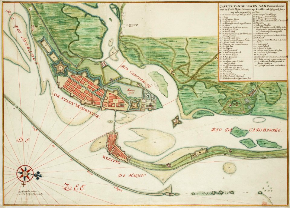
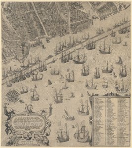
maps of the west-indische compagnie
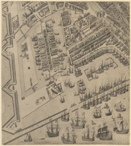
old maps of dutch brazil
the fifty-three stations of the tōkaidō (hoeidō edition, metropolitan museum of art)
utagawa school,kasei culture,ukiyo-e
the fifty-three stations of the tōkaidō (hoeidō edition, metropolitan museum of art)
utagawa school,kasei culture,ukiyo-e
drawings by cornelis troost in the rijksmuseum amsterdam
rococo
atlas schoemaker-noord-holland
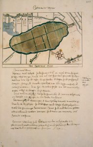
maps of wijdewormer
atlas schoemaker-zuid-holland
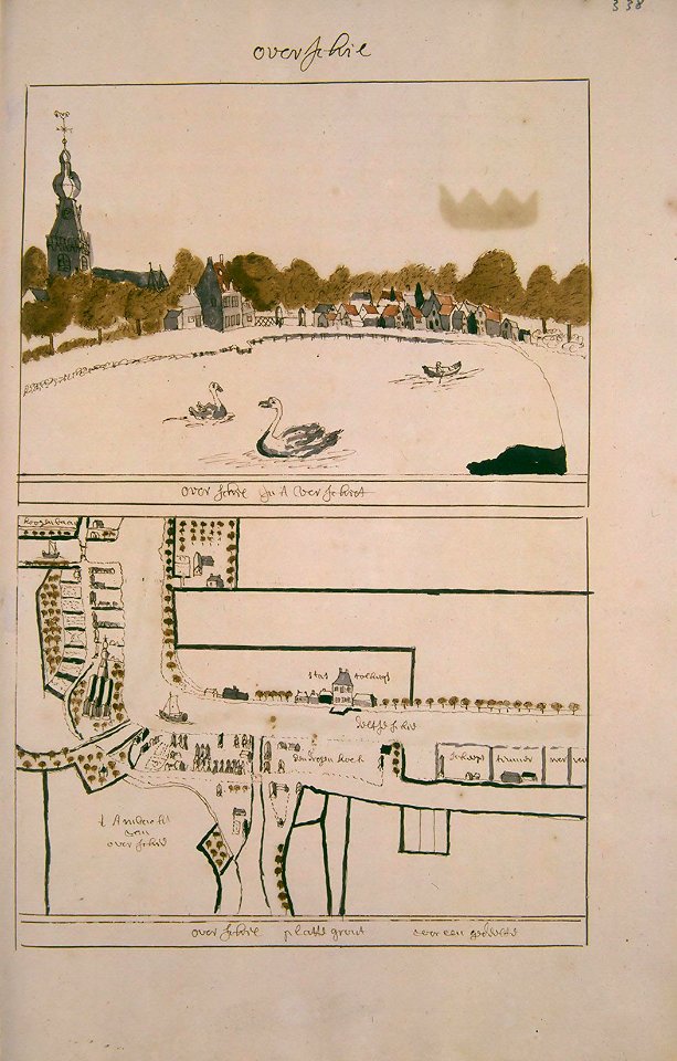
maps of overschie
atlas schoemaker-noord-holland
maps of beemster
maps of the islands of greece by marco boschini (1658)
context files from gallica
voyage pittoresque ou description des royaumes de naples et de sicile vol. 1, p. 1 (1781)
san giovanni a carbonara - cappella caracciolo del sole
utagawa school,kasei culture,ukiyo-e
ndl-dc 1307470 hiroshige gachō
auguste poulet-malassis
realism
maps of the islands of greece by marco boschini (1658)
context files from gallica
japanese prints in the metropolitan museum of art
surimono by kubo shunman
tōto meisho (famous views of the eastern capital) - tsutaya kichizō triptych version by utagawa hiroshige
utagawa school,kasei culture,ukiyo-e
duin en kruidberg, santpoort
hendrik de leth
paintings by ike no taiga in the metropolitan museum of art
japanese art in the metropolitan museum of art
drawings by franz marc
expressionism
context files from gallica
history of folegandros
cascade d'enfer (haute-garonne) in art
pierre gorse
drawings in the national gallery of art (washington, d.c.)
drawings by joris hoefnagel
watercolor drawings by johannes vingboons
old maps of maharashtra
prints in the stadsarchief amsterdam
daniel stoopendaal
maps in the stadsarchief amsterdam
claes jansz. visscher (ii)
maps in the stadsarchief amsterdam
claes jansz. visscher (ii)
maps in the stadsarchief amsterdam
claes jansz. visscher (ii)
maps in the stadsarchief amsterdam
claes jansz. visscher (ii)
het zegepralent kennemerlant
hendrik de leth
atlas van der hagen (volume 3)
atlas van der hagen
history of yasukuni shrine
inoue yasuji
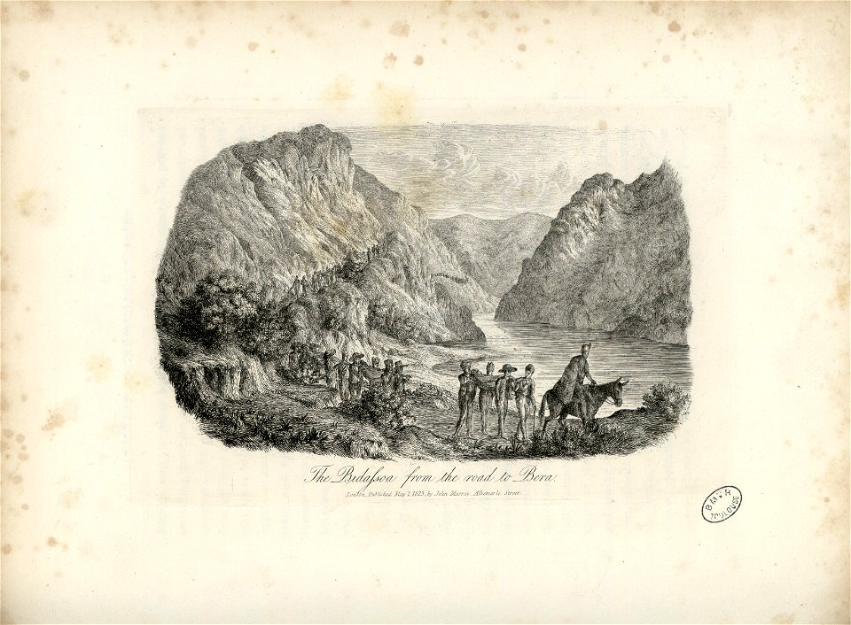
1823 paintings in spain
1823 in art
engravings in the rijksmuseum amsterdam
maps of eisenstadt by braun & hogenberg
atlas van der hagen (volume 2)
atlas van der hagen
17th-century paintings in the metropolitan museum of art
kanō school
maps of ports and fortresses of the mediterranean by marco boschini (1651)
bibliothèque nationale de france
maps of ports and fortresses of the mediterranean by marco boschini (1651)
bibliothèque nationale de france
maps of ports and fortresses of the mediterranean by marco boschini (1651)
bibliothèque nationale de france
topographisch, oeconomisch und militaerische charte des herzogthums mecklenburg schwerin and des fürstenthums ratzeburg - schmettau
topographisch, oeconomisch und militaerische charte von mecklenburg, schwerin und ratzeburg
map of the circle of swabia by sanson
bibliothèque nationale de france
topographisch, oeconomisch und militaerische charte des herzogthums mecklenburg schwerin and des fürstenthums ratzeburg - schmettau
topographisch, oeconomisch und militaerische charte von mecklenburg, schwerin und ratzeburg
sensō-e by kobayashi kiyochika
ukiyo-e
maps of ports and fortresses of the mediterranean by marco boschini (1651)
bibliothèque nationale de france
topographisch, oeconomisch und militaerische charte des herzogthums mecklenburg schwerin and des fürstenthums ratzeburg - schmettau
topographisch, oeconomisch und militaerische charte von mecklenburg, schwerin und ratzeburg
sensō-e by kobayashi kiyochika
ukiyo-e
maps of the siege of cazal (1630)
baroque
bibliothèque nationale de france
guillaume sanson
maps of blâmont by braun & hogenberg
bibliothèque nationale de france
maps of ports and fortresses of the mediterranean by marco boschini (1651)
bibliothèque nationale de france
maps of ports and fortresses of the mediterranean by marco boschini (1651)
bibliothèque nationale de france
sensō-e by kobayashi kiyochika
ukiyo-e
maps of ports and fortresses of the mediterranean by marco boschini (1651)
bibliothèque nationale de france
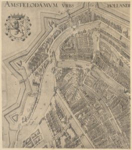
plan de paris d'ambroise tardieu - 1839
bibliothèque nationale de france
bibliothèque nationale de france
cartouches by tomas lópez
topographisch, oeconomisch und militaerische charte des herzogthums mecklenburg schwerin and des fürstenthums ratzeburg - schmettau
topographisch, oeconomisch und militaerische charte von mecklenburg, schwerin und ratzeburg
bibliothèque nationale de france
clément-pierre marillier
topographisch, oeconomisch und militaerische charte des herzogthums mecklenburg schwerin and des fürstenthums ratzeburg - schmettau
topographisch, oeconomisch und militaerische charte von mecklenburg, schwerin und ratzeburg
maps from gallica
guides joanne
topographisch, oeconomisch und militaerische charte des herzogthums mecklenburg schwerin and des fürstenthums ratzeburg - schmettau
topographisch, oeconomisch und militaerische charte von mecklenburg, schwerin und ratzeburg
old maps of norway
guillaume sanson
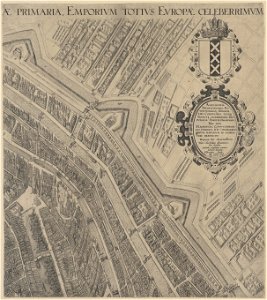
carte des environs de paris (1678)
bibliothèque nationale de france
topographisch, oeconomisch und militaerische charte des herzogthums mecklenburg schwerin and des fürstenthums ratzeburg - schmettau
topographisch, oeconomisch und militaerische charte von mecklenburg, schwerin und ratzeburg
topographisch, oeconomisch und militaerische charte des herzogthums mecklenburg schwerin and des fürstenthums ratzeburg - schmettau
topographisch, oeconomisch und militaerische charte von mecklenburg, schwerin und ratzeburg
topographisch, oeconomisch und militaerische charte des herzogthums mecklenburg schwerin and des fürstenthums ratzeburg - schmettau
topographisch, oeconomisch und militaerische charte von mecklenburg, schwerin und ratzeburg
bibliothèque nationale de france
maps by jakob van der schley
maps of archidona by braun & hogenberg
bibliothèque nationale de france
topographisch, oeconomisch und militaerische charte des herzogthums mecklenburg schwerin and des fürstenthums ratzeburg - schmettau
topographisch, oeconomisch und militaerische charte von mecklenburg, schwerin und ratzeburg
bibliothèque nationale de france
cartouches by tomas lópez
7601 - 7700 of 9,296
Next page
/ 93